Stratigraphy
The Stratigraphy tab holds the lithological column of the borehole: water table and layers with lithology, description, colour and pattern.
It is a descriptive column: it goes into the drawings and the report, but no calculation reads it. Velocities, moduli and Vs,eq depend only on the measurements and on the seismic layers of the Processing tab. If you do not need it in the report, you can leave it empty.
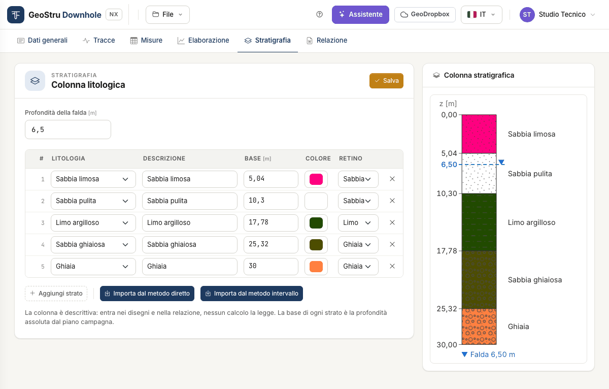
Water table
Water table depth [m] is the depth below ground level. With a value greater than zero the water table is drawn on the column and written in the report; with zero the report states that no water table was found within the investigated depth.
Layers
One row per layer:
| Field | Meaning |
|---|---|
| Lithology | One of the 14 entries of the list, from clean sand to rock. |
| Description | Free text shown next to the layer. |
| Base [m] | Absolute depth of the base below ground level, not the thickness. |
| Colour | Background colour of the layer. |
| Pattern | Hatch: sand, gravel, silt, clay, organic soil, rock, or none. |
Choosing the lithology pre-fills description, pattern and colour; a description you typed yourself is not touched.
Add layer creates a row, × removes it. Press Save to store: the column on the right is redrawn with the layers in depth order.
Importing from the seismic layers
The column often coincides with the seismic layers. Instead of retyping it:
- Import from the direct method copies the seismic layers of the direct method;
- Import from the interval method copies those of the interval method.
You get the bases, lithologies, descriptions, colours and patterns you gave the layers in the Processing tab. Layers written by hand are replaced: if there are any, the app asks for confirmation. If the chosen method has no seismic layers, the column stays empty and the app says so.
After importing you can correct the rows by hand. Column and seismic layers remain independent: moving a seismic layer after the import does not move the layer of the column.
Assigning the lithology
Velocities alone do not tell you what soil is there. Use the log of the borehole in which the test was run.
Found an error on this page? Let us know or open a Pull Request.